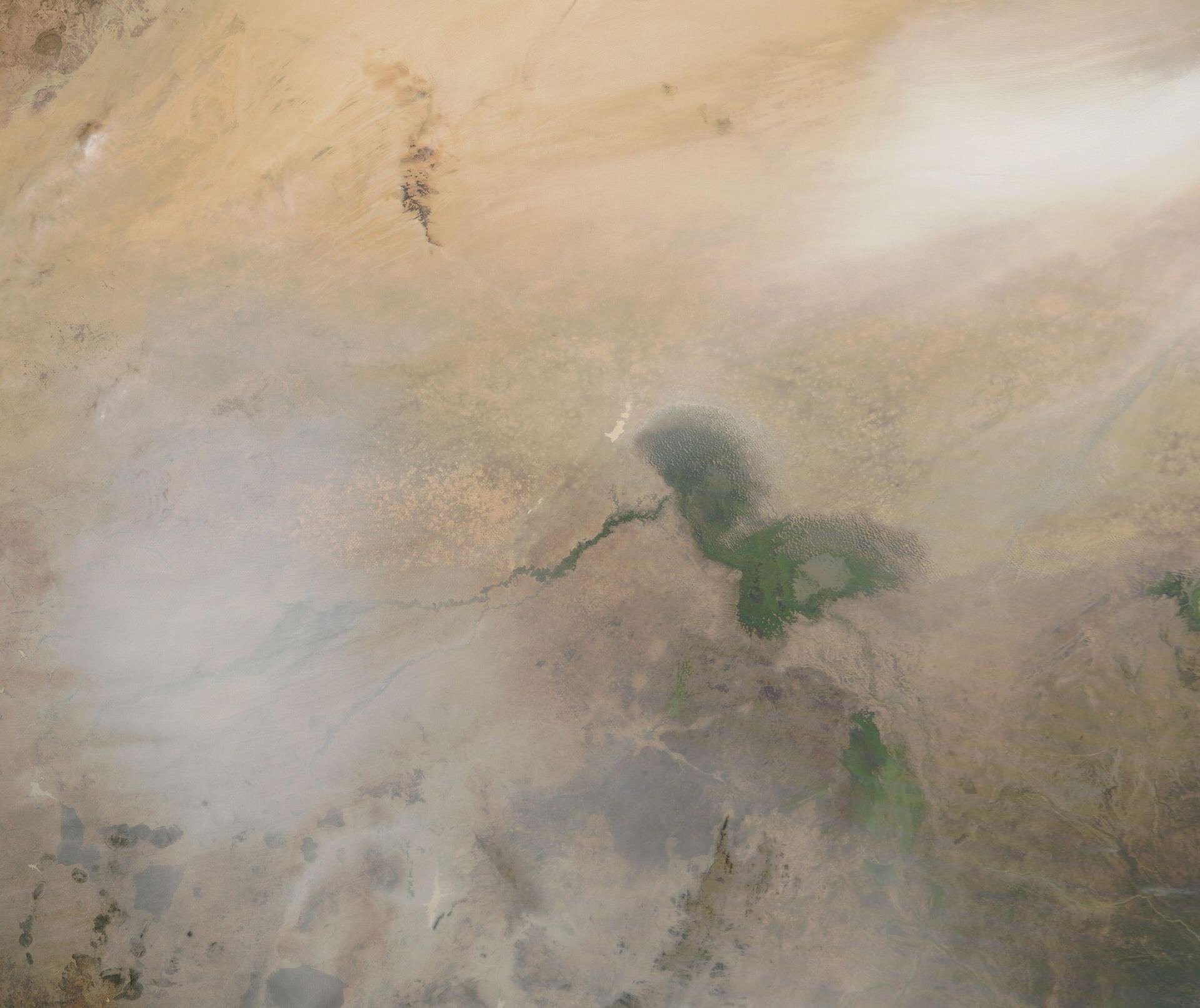
Image: MODIS, NASA GSFC · Public domain · Wikimedia Commons
RIVER BASIN · LKCH Africa · the Sahel's inland sea
Eight countries claim its basin. Thirty million people live from its water. And in the entire treaty record of humanity, they have signed exactly four agreements about it.
The disappearing sea
There is a lake in the middle of the Sahel that refuses to behave like a lake. It has no outlet to any ocean; it swells and shrinks with the rains like a living thing; and within one human lifetime it performed the most famous vanishing act in modern hydrology — from some 25,000 square kilometres in the 1960s to barely a tenth of that by the 1990s. Fishermen woke up kilometres from the water. Whole villages followed the shoreline as it walked away.
Lake Chad is the low point of an immense basin — 2.6 million square kilometres touching eight countries, from the Central African rainforest margins to the dunes of Libya. Nearly all of its water arrives from a single artery, the Chari–Logone system, and the lake repays the region by feeding, watering and employing an estimated thirty million people across Cameroon, Chad, Niger and Nigeria.
Around Lake Chad, the question is never only "where did the water go?" It is "what happens to people when it goes?"
Legends & names
The word is circular: the lake gave its Kanuri name — simply "great water" — to the country of Chad, which now shares the shrunken original with three neighbours. The Buduma people have lived on the lake for centuries, herding cattle between floating islands of papyrus. When the water walks, whole cultures walk with it.
The basin
Sources: JRC Global Surface Water (lake extent); FAO AQUASTAT (external-water dependency); WRI Aqueduct (baseline water stress). Real basin & country geometry (TFDD · Natural Earth); figures curated from published data.
Cooperation & conflict
Here is the contrast this atlas was built to show: the Danube's 62 agreements against Lake Chad's four. Not because the region saw no need — the four riparian states created their basin commission in 1964, four years after independence, one of Africa's first. But the machinery was never given the resources, the data, or the authority to match a crisis that arrived faster than any of its founders imagined.
Cameroon, Chad, Niger and Nigeria sign the Convention and Statutes of the Lake Chad Basin — creating the LCBC to coordinate use of the lake and its feeder rivers. Remarkably, the convention already addresses groundwater.
Two agreements at Yaoundé set up joint development financing — the record's only additions for four decades, both about money rather than water rules.
Sahel droughts and expanding irrigation shrink the lake through the 1970s and 80s. The "Great Lake Chad" of the maps splits into pools; fishing, farming and herding communities begin chasing the water — across borders.
The basin states adopt a comprehensive Water Charter — quantity, quality, environment, groundwater — the legal upgrade the basin had lacked for half a century. Its weakness: ratification has crawled, and it is still not fully in force.
Boko Haram turns the lake's islands and shores into a conflict zone. Millions are displaced into the same shrunken resource base; fishing bans and closed borders do what no drought could — sever people from the water that remains.
Abuja hosts a conference on refilling the lake via a canal from the Congo basin — a megaproject still on paper. Meanwhile satellite studies complicate the famous narrative: since the 1990s the lake has stabilized and varies year to year. The crisis is real, but it is as much about people, conflict and access as about disappearing water.
The cooperation indicator
Cooperative states, violent shores
The riparian governments rarely clash with each other over water — they even field a joint military force. The conflict here runs through communities: herder–farmer violence and insurgency around a contested, highly variable resource.
TFDD events 1948–2008: just 22 recorded · mean +4.77 · 95% cooperative — a very thin state-to-state record
Four treaties for eight countries
An early commission, chronically under-resourced, and a modern Water Charter still awaiting full ratification — the thinnest legal floor of any basin this size.
TFDD treaties: 4 · browse them →
Partial, and fragile
SDG 6.5.2 reporting shows partial coverage; the LCBC operates, but monitoring and enforcement depend heavily on external donors.
SDG 6.5.2: weighted 63.7% · 6 of 8 basin states reported
High — the tool's home ground
Not part of the cooperation score. The Water, Peace & Security partnership forecasts near-term conflict risk from climate, hydrological and socio-economic signals — a forward-looking companion to the historical record below.
Water, Peace & Security forecast → · a forecast, not scored here
Founded 1964 · grown from 4 to 8 members · one of Africa’s oldest river basin organizations, chronically under-resourced for the scale of the crisis it faces.
Pacific Institute typology — trigger: a dispute over water that sparks violence · weapon: water or water systems used as a means of attack · casualty: water systems damaged in fighting.
Water-conflict events recorded across Lake Chad's countries (Pacific Institute) — national and local incidents, not only transboundary disputes. Here water security and human security are the same subject.
Lake Chad breaks the neat story that water scarcity causes wars between states — the states cooperate, thinly but genuinely. What the indicator's two-out-of-five records is a harder truth: institutions too weak to protect the people inside the basin, where climate stress, displacement and insurgency feed each other. Here, water security and human security are the same subject. How this indicator is built →
The paper lake
Signed at Fort Lamy (today's N'Djamena) by the four lakeside states: a commission to coordinate development, consultation before new works — and, decades ahead of its time, explicit language on groundwater.
Two accords creating development funds for the commission — necessary plumbing, but the record's only additions during the very decades the lake was disappearing.
The modern framework at last: allocation, quality, environment, groundwater and public participation in one text. Adopted — but more than a decade on, still short of the ratifications to bind all its members.
That is the whole record: 4 treaties. The Danube has 62. This gap is the point. SOURCE: TFDD INTERNATIONAL FRESHWATER TREATIES DATABASE
What the research says
Is Lake Chad the world's first climate war? The most detailed risk assessment of the basin argues that the framing itself is part of the problem:
Calling Lake Chad a climate war lets too many people off the hook. The lake did not simply dry up and produce violence. Satellite and hydrological analysis of the last two decades finds that the lake is not currently shrinking — the catastrophic losses belong to the 1970s and 1980s, and the southern pool has been broadly stable since. What collapsed was people's capacity to live with a lake that has always moved.
Weak institutions, political exclusion and armed conflict destroyed the seasonal mobility, trade and flexible land use that let communities absorb a variable lake. The causation runs in both directions: conflict erodes adaptive capacity, and lost adaptive capacity feeds recruitment and grievance. Fix the governance, and the same climatic variability becomes survivable.
Janani Vivekananda Head of Programme, Climate Diplomacy & Security, adelphi Summarised from: Vivekananda, J. et al. (2019) Shoring Up Stability: Addressing Climate and Fragility Risks in the Lake Chad Region, adelphi (commissioned by the G7) · read the original →
Our summary of published work — not a quotationThe view from the islands
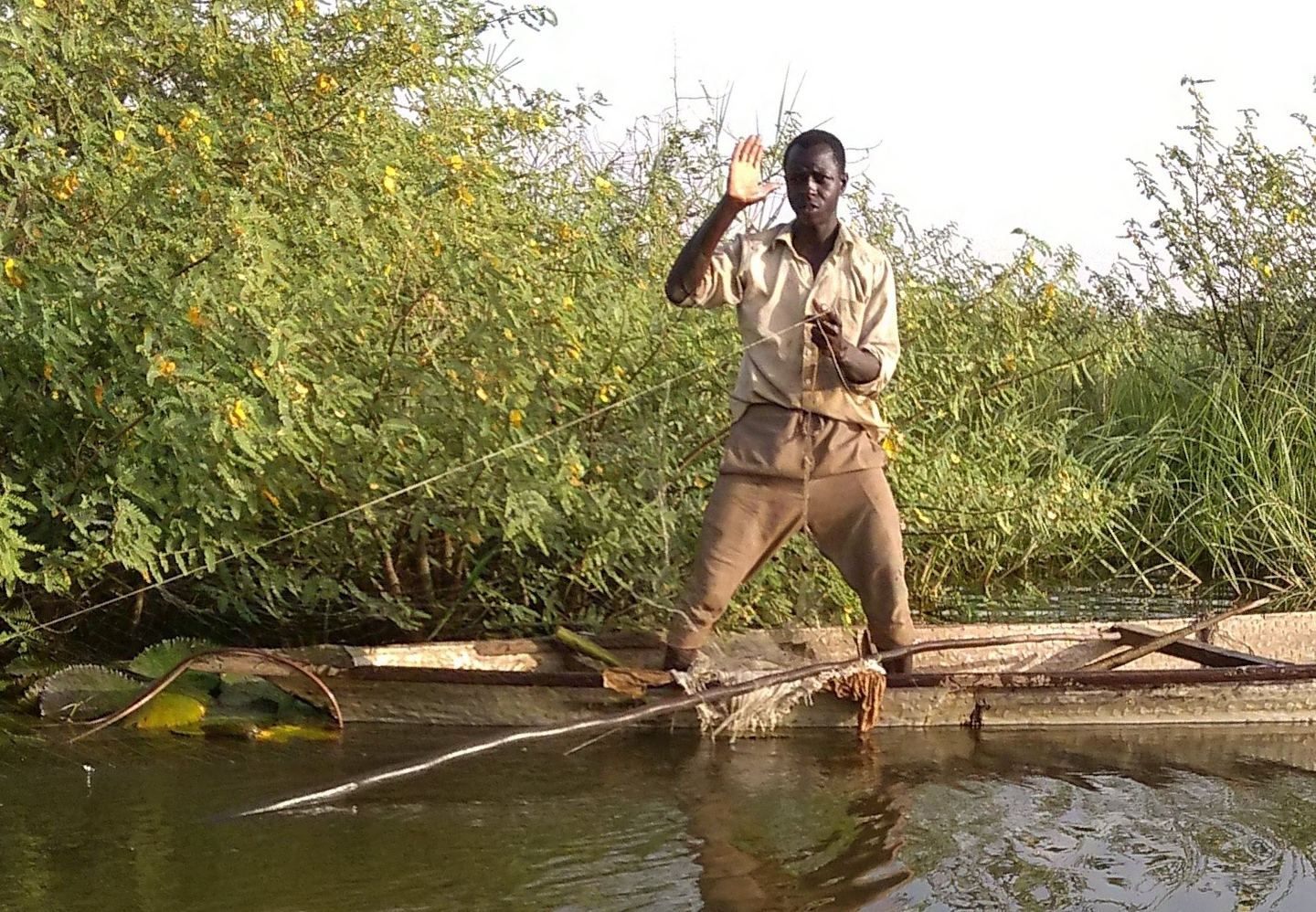
On the lake itself, among the reed islands, the crisis is measured in journeys:

We are people of the water — when it moves, we move. My family has crossed three borders without ever leaving the lake. It was never the water that stopped us; it is the checkpoints, the bans, the fear. Give us a safe lake and we will feed four countries from it.
A lake fisherman's accountComposite voice — drawn from published interviews in Lake Chad reporting (UNDP, ICRC and journalistic case studies of Buduma fishing communities) · Illustrative photo: VOA, CC BY-SA 4.0
Composite, clearly marked — not a named individual
Prospects
The spectacular answer is Transaqua: a 2,400-kilometre canal lifting water from the Congo basin to refill the lake — a scheme that has hovered between vision and mirage for forty years. The unglamorous answer is the one the science favours: ratify the Water Charter, fund the commission, restore the Chari–Logone flows, and rebuild the mobility and markets that let people follow a lake that has always breathed in and out.
Beneath it all waits a quieter reserve — the Lake Chad Basin aquifers, already tapped by millions of wells, already flagged in the 1964 convention, and still governed by no operational arrangement at all. The basin that shows the world's thinnest surface-water record may yet write the next chapter of groundwater diplomacy, because it has no choice.
The lake is not empty; the institutions are. Filling the second may matter more than refilling the first.
Next story · River basin
From the world's thinnest treaty record to its densest: nineteen countries, sixty-two agreements, and the machinery that turns disputes into paperwork instead of conflict.
Read the story →